Updated October 24, 2024 11:09AM
Mount Elbert, Colorado: How to Hike the Tallest Peak in the Rocky Mountains
14,438-foot Mount Elbert offers accessible routes ascending to the highest point in the Rockies. Here's the best way to tackle this trek.
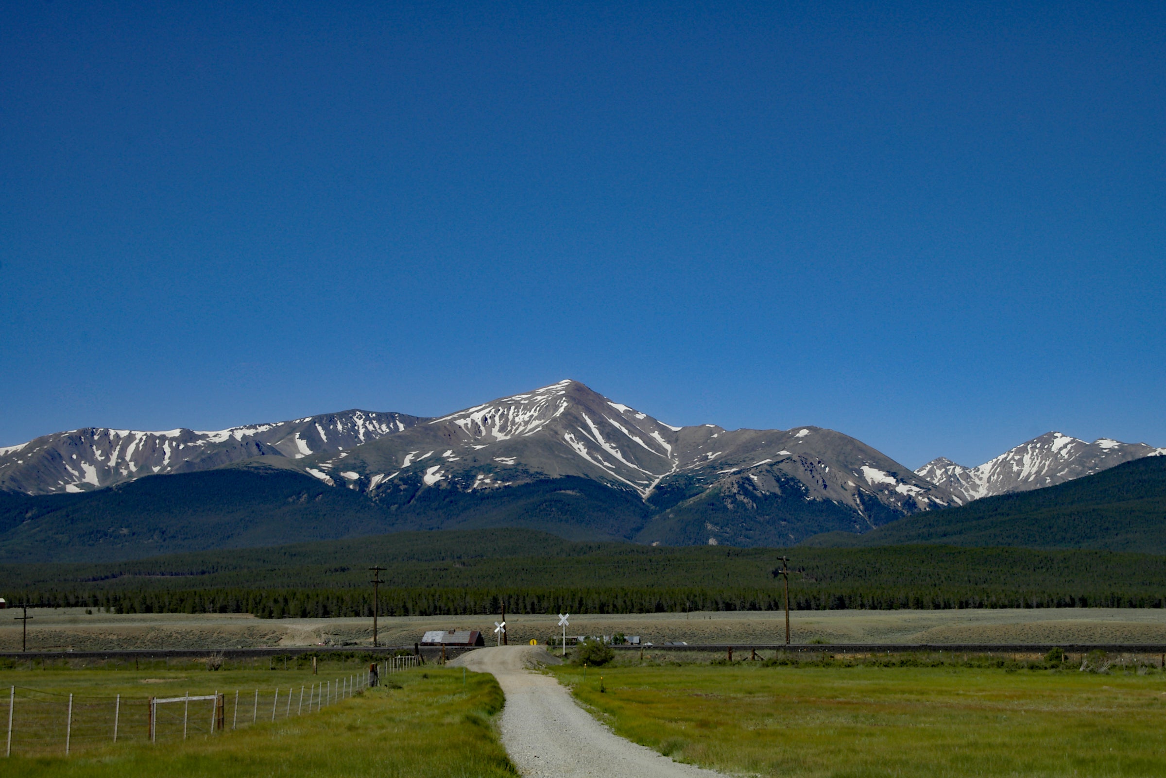
Mount Elbert as seen on the approach from Leadville. (Photo: James Dziezynski)
Mount Elbert’s status as the highest peak in Colorado is disguised by its modest yet massive profile. The mountain’s once-jagged contours have been smoothed out by ancient glaciers, a characteristic shared by many of its neighboring Sawatch Range summits. Millennia of erosion has transformed Mount Elbert into a gentle giant, offering several non-technical hikes to the top. The standard route most hikers use is the Mount Elbert Trail, located just outside of the town of Leadville, Colorado.
I’ve hiked to Mount Elbert’s summit ten times. I’ve been up in every season, with and without dogs, and with hiking companions of various fitness levels. It’s one of my favorite 14ers in Colorado and I’m certain I’ll be back again. Based on my experience, the key to enjoying Mount Elbert is knowing what to expect and how to prepare for this venerable king of the Rockies.
Mount Elbert via the Mount Elbert Trail
The aptly named Mount Elbert Trail is the best-maintained route to the summit. This non-technical path is a Class 1 walk-up with a smattering of easy Class 2 terrain near the top. By Colorado standards, this is a moderately difficult route whose primary concern is the high altitude. The burly 4,500 feet of elevation gain is no joke, but thankfully, the trail is well-maintained and easy to navigate.
ADVERTISEMENT
Mount Elbert Trail Stats
📍 Distance: 9.3 miles out-and-back
⏱️ Hiking Time: 5 – 7 hours
⛰️ Starting Elevation: 10,066 feet at Mount Elbert Trailhead
🥾 Total Elevation Gain: 4,500 feet
☀️ Best Time to Hike: June through September
Getting There: Mount Elbert Trailhead
Google Maps GPS Coordinates: 39.15192368628267, -106.41243389546963
Mount Elbert is about a 30-minute drive from Leadville. From town, go 3.5 miles south on US Highway 24. Turn right (south) onto CO Highway 300. Go 0.7 miles and turn left onto CO Highway 11, also called Halfmoon Road. Follow this for 1.8 miles, then turn right to continue on CO 11/Halfmoon Road. Here, pavement turns into a well-maintained dirt track, passable by all vehicles (except in snowy conditions, of course). Go 6.8 miles until you hit the Mount Elbert Trailhead on your left. Directly across from the trailhead is the Elbert Creek Campground, a first-come, first-served campground with 17 sites and a restroom. ($22 per night)
About 500 feet past the campground, there is free primitive camping, mainly on the left side of the road. Note that the road becomes more rugged past the campground, and you should use a 4×4 vehicle if you explore this area.
ADVERTISEMENT
What to Expect on the Hike
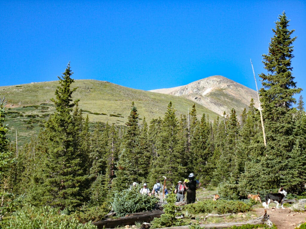
The Mount Elbert Trail starts in a pine forest and gets right down to business. Its ascent begins quickly, so don’t go too hard out of the gate. At 0.9 miles, the Mount Elbert Trail splits at a signed junction from the common path it temporarily shares with the Colorado Trail.
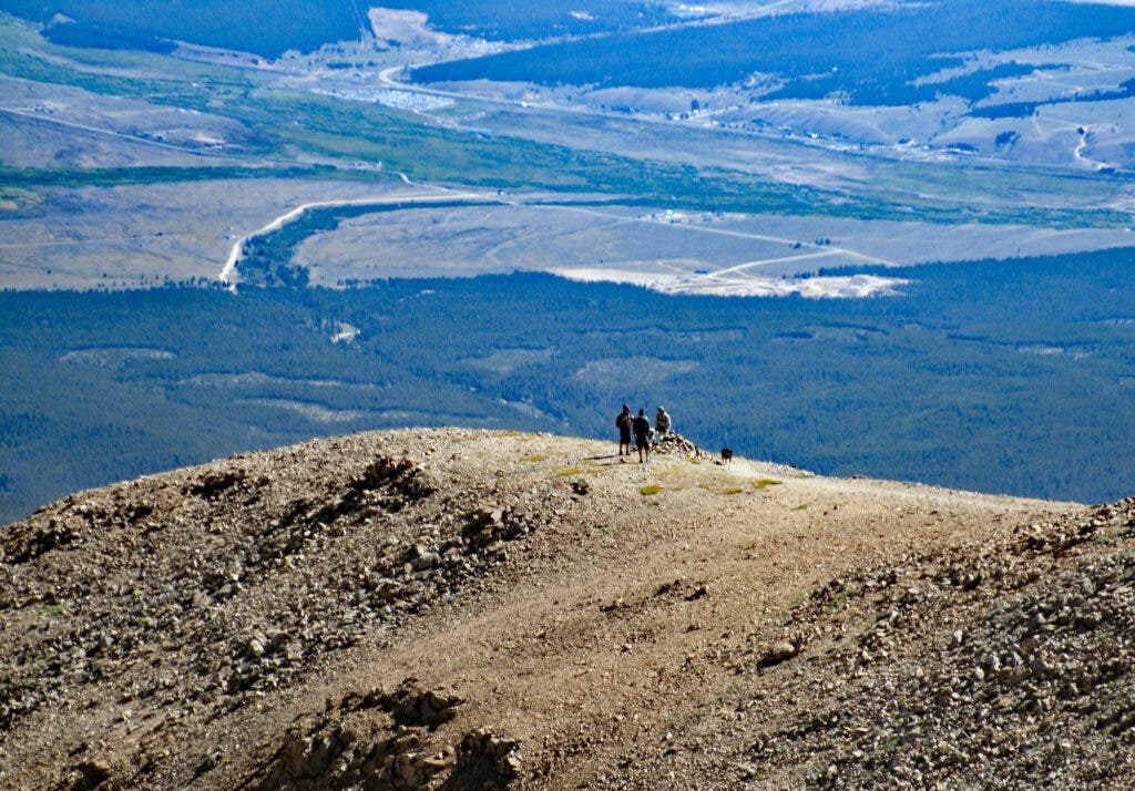
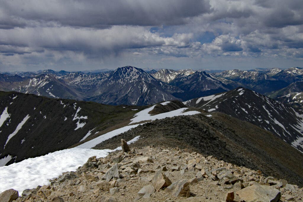
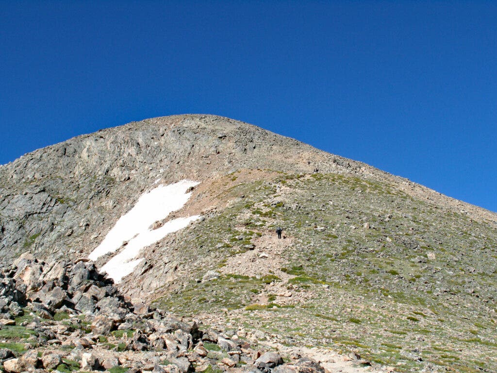
From here, it’s a big push to the top. At about 12,000 feet, the trail breaks through treeline into alpine tundra where the real work begins. Morning clouds often settle in the valleys below, amplifying the sensation of high elevation. There are no significant sections of exposure as the trail follows the rounded terrain of the Northeast Ridge.
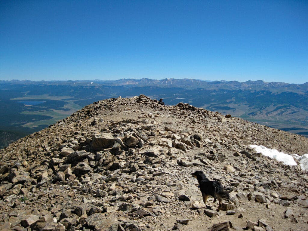
At 3.1 miles, don’t be fooled by a false summit at the top of a rocky portion of the trail. Above this point, the trail eventually gains the broad summit shoulder and tops out at roughly 4.7 miles. Once you’ve soaked in the views from the tallest mountain in Colorado, return the way you came.
ADVERTISEMENT
Navigation is relatively easy, barring any significant fog, storms, or clouds.
Tips and Advice for Maximizing Your Mount Elbert Hike
Two major concerns when hiking Mount Elbert are altitude sickness and lightning storms. The good news? You can mitigate both with a bit of Rocky Mountain wisdom.
- Altitude sickness can affect even well-acclimated Colorado locals at these high elevations. Out-of-town hikers should take extra care when dealing with altitude. If possible, aim to build a progression of elevation gain the couple of days before you tackle Mount Elbert. This can make a huge difference in succeeding on the 14er—and feeling good when you do it. To do this, sleep at 7,000 – 8,500 feet two nights before, then 9,000 – 10,000 feet the night before your hike, to help your body adjust to the thin air. Note that both the Elbert Creek Campground and lodging in the town of Leadville sit at 10,000 feet. Even if you toss and turn a bit, spending the night at this elevation will increase red blood cells and help with the lower oxygen levels at 14,000 feet.
- Storms are normal in spring, summer, and early autumn. Most roll in about 1 – 2 P.M. daily during these times. My advice is to start early, around or before 5 A.M. Make it your goal to be off the summit no later than 11 A.M. Check the local forecast. If thunderstorms are forecast earlier than noon, consider hiking another day. Lightning storms above treeline are dangerous, as there’s nowhere to seek shelter.
Other Things to Know Before You Hike Mount Elbert
- Food and hydration will keep you powered up and cramp-free. Eating a big, carbohydrate-rich dinner the night before is a good strategy (especially if you, like me, don’t have much of a pre-dawn appetite for a hearty breakfast). Bring three liters of water for the day and sip regularly—dehydration can sneak up on you at high altitudes. Remember to keep drinking and snacking on the way down as well. Gels and energy blocks can help if your stomach is not up for richer, denser foods.
- Sunblock, UPF long-sleeved shirts, and polarized sunglasses will prevent intense solar rays from roasting your skin and punishing your eyes.
- Bring layers adequate for cold, windy conditions. This should include a warm mid-layer, like a puffy jacket, as well as a waterproof rain shell, a winter hat, gloves, and a neck gaiter. Even if it’s hot at lower elevations, the temperatures and wind at 14,000+ feet can make summer days feel like winter.
- Light hikers or boots and hiking poles will help reduce wear and tear on your knees and legs. Because there is no technical terrain on the Mount Elbert Trail, light hikers usually work just fine as long as the mountain is free of snow. (The snowpack typically melts by the 4th of July.)
- A daypack with enough room to carry your layers and snacks is a no-brainer.
- A navigation app like Gaia GPS will keep you on track and record your adventure. Even though there’s really only one major, well-marked turn, people do miss it in the morning darkness and wander along the Colorado Trail, blissfully unaware that they are going the wrong way.
- A headlamp, first-aid kit, and map (either digital or, better, physical paper) round out my ideal gear list.
- Dogs are allowed on the mountain. Make sure that you have plenty of water and food for your pup, though. Experienced hiking dogs will have a lot of fun on Mount Elbert, but keep them on leash due to the presence of other hikers and wildlife, like marmots and pikas.
Final Thoughts
Mount Elbert will be more enjoyable if you have solid fitness, altitude acclimation, and the right gear. The elevation gain is gradual but will still fizzle out your legs if you haven’t already logged uphill miles before your adventure. Training on mountains with 2,500 – 3,000 feet of elevation gain and distances of 6 – 10 miles will prime your body for an excellent day on Elbert.
ADVERTISEMENT
For out-of-towners and beginners, consider tackling a progression of hikes over four or five days to prepare for Mount Elbert. I suggest starting with 8,460-foot Bear Peak in Boulder, then take a rest day. On day three, hike 13,229-foot Mount Audubon (near Boulder) or 13,433-foot Grizzly Peak D off of Loveland Pass. Then, take another rest day, sleeping at over 8,000 feet. End with your Mount Elbert climb on day five, after you’ve built up stamina for both altitude and steep ascents.
In my experience, Mount Elbert is actually on the easier side compared to other Colorado 14ers. The collection of 58 peaks that make up the recognized 14ers has a wide range of difficulties, and Elbert’s non-technical, well-documented route makes it a challenging but accessible adventure for 14er newbies. Plus, in years when Colorado’s snowstorms arrive later in the winter and spring, it’s possible to enjoy a snow-free hike as late as mid-October, which is a special treat because lightning storms are less prevalent, and the crisp, cool air can keep hot hikers like myself more comfortable.
All told, Mount Elbert is a stunning adventure that is most fun when you use a winning strategy to hike to the summit. Start early, acclimate, eat and drink regularly before and during your hike, and watch the weather. Oh, and don’t forget to enjoy your brief tenure as the highest person in Colorado before you make the descent.
About the Author
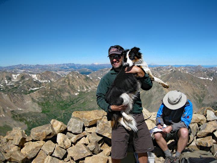
James Dziezynski is the author of six Colorado mountain hiking guidebooks and the SEO Director at Outside. He’s been to the summit of Mount Elbert 10 times, including a coincidental trip to the top in 2001 on the same day the Stanley Cup (yes, THE Stanley Cup) was brought up, too.