

If today’s Atlanta were a person, it would wear a whistle around its neck and sport a coach’s white sneakers. It would tell Atlantans to go take a lap.
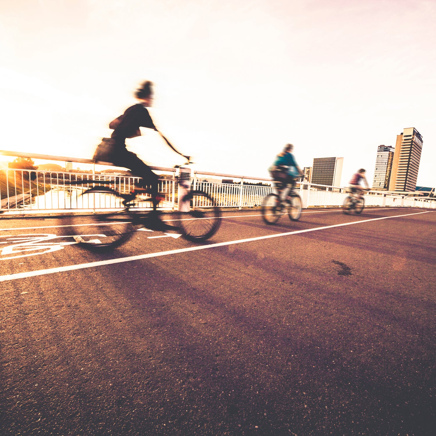
Atlanta, like a significant number of America’s major cities and modest towns, is going to unprecedented lengths so that its citizenry will open their front doors, enjoy the breeze and greenery, and go break a sweat. This is most clearly illustrated by the city's impressive, and ultimately massive, BeltLine pathway—a 14-foot-wide, 22-mile-long paved recreational path that, when completed in 2030, will surround the entire city core in a pear-shaped loop. The project is emblematic of what is now a national movement to thoroughly knit the outdoors and nature into a town's concrete and asphalt.
“Being in your car multiple hours per day is not good,” says Rob Brawner, executive director of the Atlanta BeltLine Partnership, a nonprofit established in 2005 with the goal of raising capital and growing civic support for the project. “We think people have an innate desire to get outside.”
The early success of the BeltLine—largely a collection of converted railway corridors—has inspired the major metro area to get healthy. In 2015, well over a million people used the BeltLine’s already completed (but still modest) 2.25-mile Eastside Trail by foot, bicycle, and scooter. Alongside the path, there’s a skate park and regular opportunities to take boot camp, yoga, and aerobics classes. When the $4.8 billion BeltLine is finished, it will connect 45 Atlanta neighborhoods and offer access to approximately 2,000 acres of adjacent parkland. The New York Times recently called the project “potentially transformative.”
The nationwide trend of cities and municipalities prioritizing natural places to play is more than coincidental or even intentional. It’s imperative.
“The BeltLine will provide fundamental changes to how people live,” says Brawner. “Biking to school. Walking to stores.”
Atlanta isn't alone. Other cities, both small and large, are embarking on similar initiatives. Groundbreaking for Miami’s proposed 10-mile Underline linear park—which will occupy currently unused land beneath the city’s elevated Metrorail—will likely happen next year. New York City’s partially built Freshkills Park, on Staten Island, was previously the world’s biggest landfill, and will measure 2,200 acres when completed in 2036. And recently, the tiny city of Whitefish, Montana (year-round population: 6,500), began construction on a massive 55-mile trail built largely by and for its inhabitants. From Seattle to Santa Fe, Bozeman to D.C., you’ll find equally ambitious and awesome projects. The nationwide trend of cities and municipalities prioritizing natural places to play is more than coincidental or even intentional. It’s imperative.
Cities are booming. According to an urbanism study conducted this year by Washington D.C.’s George Washington School of Business, the nation’s 30 largest U.S. cities host 46 percent of the nation’s population and generate 54 percent of America’s gross domestic product. Millennials are pouring into urban centers, which are enjoying rental-rate premiums 90 percent higher than their suburban counterparts. The modern-day dilemma for city governments and planners doesn’t concern mass exodus to the ‘burbs. Instead, cities want to keep people from leaving for other cities. One way to add appeal: building kick-ass parks and trails.
“We’re in the biggest period of park expansion and development since the WPA [Works Progress Administration] era of the 1930s,” says conservationist Adrian Benepe, director of city park development for the Trust for Public Land. “Cities are competing to see who can build the biggest, the best.”
The young workforce still wants some of what they might have grown up with in the suburbs, like green space and places to ride bikes, says Benepe, who previously served as a commissioner of New York City’s Department of Parks & Recreation. “Millennials want to have the art and culture of a city, and they want suburban amenities like soccer fields and extended paths,” he says. “So city governments have come to understand that quality of life is in part now defined by parks and recreational facilities.”
Cities want to keep people from leaving for other cities. One way to add appeal? Build kick-ass parks and trails.
It can also mean improved access to inner cities and downtown areas, says Brawner of the Atlanta BeltLine Partnership. “More diverse transportation solutions are increasingly critical.”
Bike friendliness in particular has become important to cities. In the last several years, huge metros—including Washington D.C., Fort Lauderdale, New York City, and Seattle—have championed a plan called “Vision Zero,” a Swedish concept developed in the 1990s stating that every single traffic-related death (cyclists and otherwise) is preventable if governments utilize smart policy and urban planning. The high-minded notion, which has been implemented in various European countries for decades, has already led to better and safer city riding in America.
Portland, Oregon, features a stretch of fledgling, slightly raised bike paths to better define boundaries between car and bike lanes; Chicago and Washington D.C. place curbs and islands between motor vehicles and cyclists; and Denver places automobile parking spaces between riders and other traffic. Earlier this year, New York City’s Pulaski Bridge, which runs between Brooklyn and Queens, unveiled bike lanes separated from cars via concrete barrier.
And cities take pride in caring for their active inhabitants. Minneapolis brags about having “America’s first bicycle freeway.” Portland gives city cyclists a phone number to call for bike-route maintenance and fixes. And New York recently boasted that two years after the launch of its own Vision Zero, 2015 was the safest year in the city's history.
To implement plans that people will actually use, many city planners are turning to social media, which has recently played an integral role in helping shape the design of cities and how we interact with them. In 2014, Strava—the social-networking app that tracks and captures the GPS data of its members’ eight-million-plus weekly swims, bike rides, and runs—created a service called Strava Metro. Metro harnesses and anonymizes activity data, and then sells it to cities and government organizations interested in gleaning information about how their cyclists and pedestrians mesh with urban infrastructure. In Strava Metro's two years of existence, more than 85 municipalities and groups have used it.
“We have a wide range of clients—from smaller places like Oakville, Ontario, to the Florida Department of Transportation,” says Strava Metro spokesperson Brian Devaney.
In 2014, Brisbane, Australia (population: two million), employed Strava Metro to help it evolve existing bike routes as well as develop new ones. Brisbane is the capital of Australia’s northeastern state of Queensland, which in the last 13 years has spent over $1 billion building cycling infrastructure to, among other reasons, battle both carbon emissions and the state population’s high rate of obesity.
Cities take pride in caring for their active inhabitants
Metro proved that city planners were on the right track. In September 2015, workers completed a new section of Brisbane’s Enoggera Creek Bikeway to redirect cyclists away from traffic signals and dangerous commercial districts. The nearly half-mile path, which travels under a six-lane highway and took about six months to finish, spurred more people to get on their bikes. Soon after the new stretch of pavement opened, Strava showed that rides within a one-kilometer radius of the added bikeway increased by 23 percent. Beyond the one-kilometer radius to the west, participation jumped 57 percent.
“More and more cities are using Metro data to understand how the behavior of cyclists and pedestrians change,” says Devaney, who notes that his company and its clients are able to correlate some data—every Strava trip represents just two-to-five percent of all similar rides taken. “You can change a component of the ecosystem and then follow the ripple effect ten or 15 blocks away,” he says.
Strava claims that nearly half of all the rides it captures in busier urban metro areas are commutes. Such valuable information means that in coming months and years, Strava Metro’s reach and influence on a city's commuters will likely only intensify.
But it isn’t just giant metro areas that are working to increase how active their residents are. “Towns that other people consider rural are definitely learning to better manage their public assets,” says the Trust for Public Land’s Benepe.
The modest city of Sandpoint, Idaho (population: 7,500) has a particularly rich tale around the notion of blended resources, citizenry, and fitness. Sandpoint, which is the largest city inside of sparsely populated Bonner County (40,500), faced two significant hurdles in making its residents more active: over one quarter of adult Idahoans are obese, and 15 percent of Bonner County residents live in poverty. While land conservationists were effectively preserving Bonner County’s open space in the name of wildlife corridors, forestry, and even recreation, there was one nagging problem—the locals weren’t using the resources.
“We decided that if we can’t find ways to connect people to nature and land, we may as well not be doing land protection,” says Eric Grace, executive director for Sandpoint’s nonprofit Kaniksu Land Trust. “No use in birdwatching if 99 percent of the people here don’t watch birds.”
Civic leaders are realizing that a well-placed, well-intentioned sidewalk can radically alter communities, public health, and people’s outlooks on life.
In September 2015, Grace networked his organization to work with seven local medical practitioners and 70 participants in a program called ParkRx, an initiative led by organizations including the National Recreation and Park Association and the National Park Service. ParkRx is its own kind of medicine: via the plan, doctors literally prescribe specific outdoor exercise to their patients. The initiative boosts fitness as well as appreciation for parks and open space, and has positively affected people in cities like Pittsburgh, Pennsylvania, Washington, D.C., and little Sandpoint, Idaho.
Grace’s organization initially contributed by simply steering a trickle of people toward the best places to exercise—like parks or trails found in tiny Dover, and Ponderay. But at the conclusion of the seven-month pilot program, the plan opened up to more local medical practitioners, and much of Bonner County’s citizenry. Local physicians prescribed a bigger caseload of patients to a couple-hundred yards of walking or jogging; or perhaps to 10,000 steps of running. The Kaniksu Land Trust became more involved, to the point that it has now touched the lives of hundreds of Sandpoint residents.
Grace says that he no longer takes living the active lifestyle for granted. His organization is in contact with local thrift stores for ParkRx patients who may need a workout jacket or pair of shoes, but don’t have the means to buy them new. He realizes that some ParkRx participants don’t have cars, or gas money, or that they can’t get to the open spaces because of work demands. Some also don’t have neighborhood sidewalks, which could help them to squeeze in their workouts.
“Imagine how eye-opening this has been to me. All my life I’ve been telling people to appreciate open space,” says Grace. “Now we’re working with Sandpoint to make better sidewalks. A land trust, and that’s what we’re asking for.”
Whether a city is tiny or enormous, civic leaders today are realizing that a well-placed, well-intentioned sidewalk—be it a couple blocks in length or 22 miles around—can radically alter communities, public health, and people’s outlooks on life. The happy trend toward ever-greater urban parkland and escapes proves that you really never can have too many people, in too many urban spaces, who lust for some sunshine and a sweet and unfettered place to stretch one’s legs.
“I live in a BeltLine neighborhood,” says Rob Brawner, the executive director of the Atlanta BeltLine Partnership. “I’m one of those people who wants to walk around, too.”